
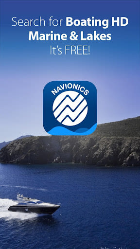
Boating Marine & Lakes
3.50
-

Language
English
-

OS
iOS, Android
-

Developer
Navionics Srl
-

#Version
17.2.1
App Description
Discover the Ultimate Water Activities Companion
Welcome to your go-to app for all things water-related – whether you're cruising, fishing, sailing, diving, or simply exploring the aquatic world. Our directory listing website offers a comprehensive range of marine and lake nautical charts and advanced features that rival even the best GPS plotters.
Features and Benefits
-
Try for Free: Dive right in by downloading our app to access all charts and features for a limited time.
-
Subscribe: Kickstart your journey with a 1-year subscription that unlocks a world of possibilities:
- Download chart layers for offline use (permanent).
- Access daily updates, chart overlays, and advanced features (renewable).
-
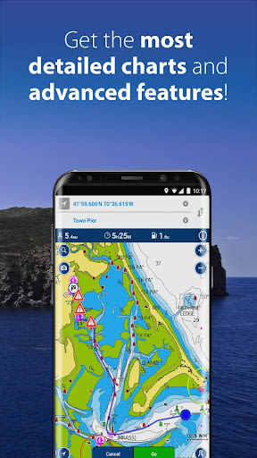
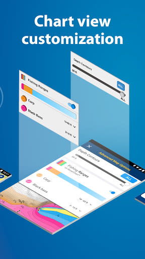
Chart Layers for Offline Use: Enjoy a variety of map options, including:
- Nautical Chart: Detailed cartography for lakes, rivers, and marine areas.
- SonarChart™: High-definition bathymetry map with exceptional bottom contour detail.
- Community Edits and ActiveCaptain® Community: Crowd-sourced local information for boaters.
- U.S. Government Charts (NOAA) covering various regions.
-
Daily Chart Updates: Stay current with up to 5,000 daily chart updates to ensure accurate navigation.
-
Advanced Features: Enhance your boating experience with:
- Chart Overlays like SonarChart Shading, Relief Shading, Sonar Imagery, Terrain, and Satellite views.
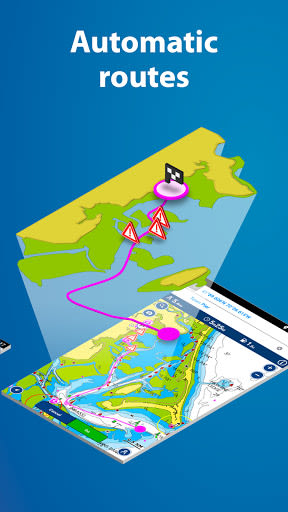
- Dock-to-Dock Autorouting for efficient trip planning.
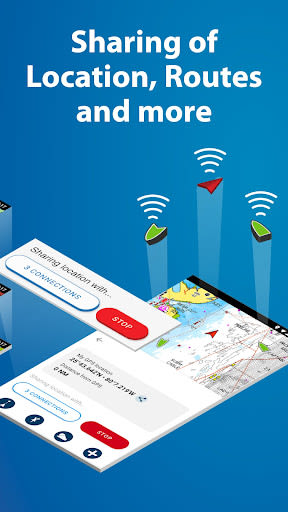
- Connections to stay connected with your boating community.
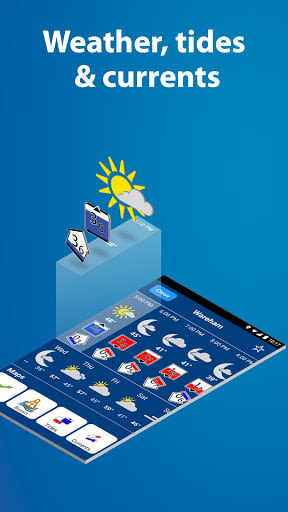
- Weather and Tides information overlaid on your map.
- GPX Import/Export for easy data sharing and storage.
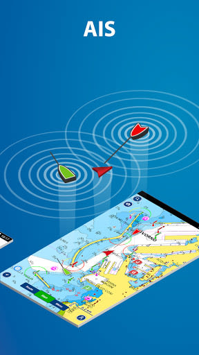
- AIS integration for real-time marine traffic monitoring.
- Plotter Sync to transfer data seamlessly between devices.
- Timeline feature to reminisce about past trips.
-
Renew Subscription: After a year, renew your subscription or continue using free features.
-
Free Features: Enjoy SonarChart™ Live, track, route, markers, wind forecasts, map options, and more at no cost.
Why Choose This App
- Comprehensive Coverage: From detailed charts to advanced features, we've got you covered for all water activities.
- Real-Time Updates: Stay informed with daily chart updates and weather data.
- User-Friendly Interface: Easily navigate through features and customize your experience.
- Community Integration: Connect with fellow boaters and share experiences seamlessly.
- Enhanced Safety: Access AIS data and plotter sync for enhanced navigation.
Technical Information
- Compatibility: Works on devices with an OS of 5.0 or higher.
- Wi-Fi Requirement: Wi-Fi connectivity for specific features.
Get Started Today!
Whether you're a seasoned sailor or a novice explorer, our directory listing website is your ultimate companion on the water. Download the app now and immerse yourself in a world of marine adventure!
Screenshots
Videos
Similar

Offline Maps, GPS, Speedometer
Appcentric Team
Phone Locator - Phone Tracker
UNSoft Global
GPS navigation, maps & route
Cyrax Global Apps
GPS Voice Navigation: Live Map
Droid-

King Compass 2019 (no ads)
Clark Wain

Organic Maps: Hike Bike Drive
Organic Maps

Mapy.cz: maps & navigation
Seznam.cz, a.s.
Speedometer: GPS Speedometer
Simple Design Ltd.

Fake GPS Location Change Spoof
iCareLife - GPS Phone Number Locator - TikDownload

The Parking Spot
TPS Parking Management LLC

Argo - Boating Navigation
Argo Navigation, LLC

MKB Brandstof
MKB Ondernemers