

DroneDeploy - Mapping for DJI
4.10
-

Idioma
English
-

OS
iOS, Android
-

Developer
DroneDeploy
-

#Versão
4.86.0
Descrição do Aplicativo
DroneDeploy: Empowering Aerial Data Exploration and Mapping
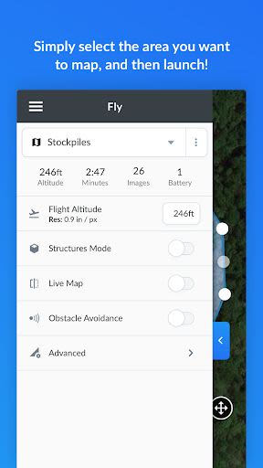
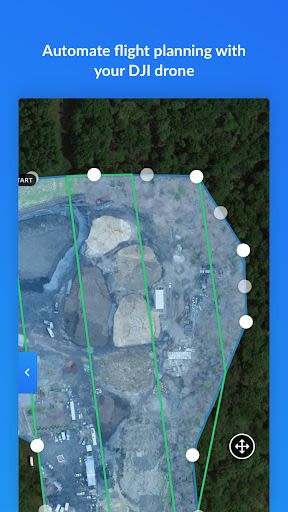
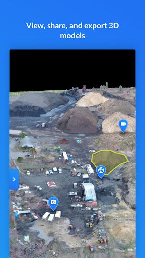
DroneDeploy stands out as the premier cloud software platform tailored for commercial drone operations, revolutionizing the accessibility and efficiency of aerial data utilization. With its free app, DroneDeploy simplifies automated flight and data capture processes, allowing users to delve into high-quality interactive maps, orthomosaics, and 3D models directly from their mobile devices. Take your DJI drone to the skies effortlessly with just two taps on your Android device.
Key Features:
-
Automated Mapping for Beginners and Professionals:
- Create flight plans on any device easily.
- Automate takeoff, flight, image capture, and landing.
- Stream First Person View (FPV) live.
- Resume control with a tap.
- Seamlessly continue flights to map vast areas without interruptions.
-
In-field Data Analysis on Any Device:
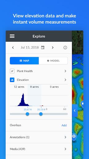
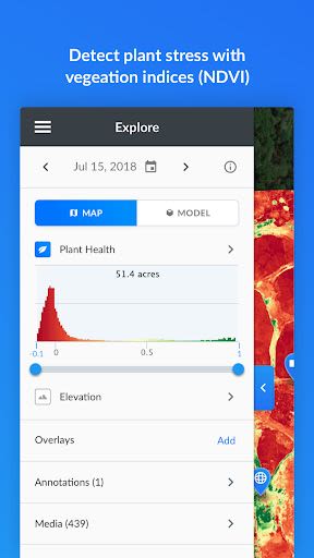
- Explore Orthomosaic, NDVI, Digital Elevation maps, and 3D models.
- Measure elevation, distance, and area.
- Collaborate via shared maps and comments.
- Access in-app support when needed (for paid customers).
Benefits:
- Enhanced Capabilities: Over 80 best-in-class apps available in DroneDeploy's App Market.
- Versatile Applications: Ideal for construction, solar, agriculture, surveying, mining, insurance, inspections, and more.
- Global Reach: Over 30 million acres mapped and analyzed across 160+ countries.
Why Choose This App:
- Effortless Integration: Compatible with DJI's latest drones, including Mavic 2 Pro/Zoom/Enterprise, Phantom series, Inspire series, and Matrice series.
- Advanced Functionality: Enables high-resolution mapping, 3D model generation, analysis, annotation, and easy sharing.
Technical Information:
- Compatibility: Android 7.1+
- Image Processing: Available on dronedeploy.com for detailed analysis and high-resolution 3D map creation.
- Export Options: Export data in your desired format for further use.
DroneDeploy caters to a diverse array of users seeking top-notch aerial imaging and mapping solutions, from industry professionals to enthusiasts. Join the community at DroneDeploy Forum to contribute and enhance your app experience.
Take your aerial data exploration to new heights with DroneDeploy – Download now and redefine your mapping capabilities!
Capturas de Tela
Vídeos
Similar

Windows 11
Microsoft

Wear Flashlight
CodVerter

Grok
xAI

Cleaner Antivirus VPN Cleaner
Cleaner + Antivirus + VPN company

owoTrack
Finoki

تەختەکلیلی کوردی | Kurdish Keyboard
Goran Gharib

Icon Torch - Flashlight
Aleksandr Balaev

Secure VPN
Dream limited

VPN Proxy Master - Secure VPN
Share File Technologies by 090 Bravo

Give VPN
Speed Group dev

Super Antivirus - Clean Virus
SUPER ANTIVIRUS

Fly Browser-Search & Private
Readerland